
可以提供哪些与地图发布相关的服务?
 为您提供离线地图发布与调用的源码示例
 提供海量地图发布中间件
 提供全国离线卫星地图二维GIS系统解决方案
 提供全球离线三维地球触摸GIS系统解决方案
什么是地图发布?
地图发布是指在互联网或局域网服务器中,通过IIS、Apache或ArcGIS Server等系统服务为地图瓦片分配唯一URL地址的过程。地图发布后可以结合百度离线API或离线API等开源平台方便地部署百度离线地图、离线地图、三维离线地球和进行离线GIS系统开发等。
部署百度离线地图
部署离线地图
部署三维离线地图
离线GIS系统开发
哪些用户需要进行地图发布?
个人用户
Personal User

需要基于离线API或百度离线API进行二次开发和学习研究的个人用户,需要进行小范围的地图发布。
企业单位
Enterprises

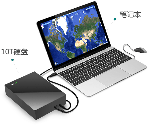
需要基于二维开源GIS平台构建全国离线地理信息系统的用户,需要进行全国卫星影像地图发布;全国卫星影像离线数据小于8T,一个移动硬盘即容纳,可以通过接入笔记本加载全国数据,适合为客户作数据展示或进行野外离线调绘作业等。
事业单位
Institutions

需要在局域网内构建一套全球离线三维GIS系统的用户,需要进行全球离线卫星影像地图发布;全球卫星影像数据在100T左右,需要阵列柜进行存储,一般用于军队等有保密要求的事业单位,可与互联网进行物理隔离,从而保障业务数据安全,大大降低涉密数据外泄或丢失的风险。
可以用哪些软件进行地图发布?
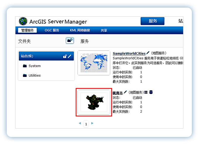
ArcGIS Server
ArcGIS Server 是提供面向 Web 空间数据服务的一个企业级 GIS 软件平台,对瓦片进行发布是该软件最重要的功能之一,通常用配套的 ArcGIS API 对其发布的数据进行调用。
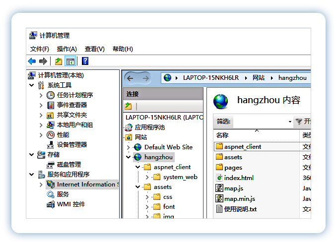
IIS
IIS 是由微软公司提供的基于运行 Windows 的互联网基本服务,它通常用于网站发布。用该软件进行地图发布,其实就是发布一个具有地图显示功能的网站。
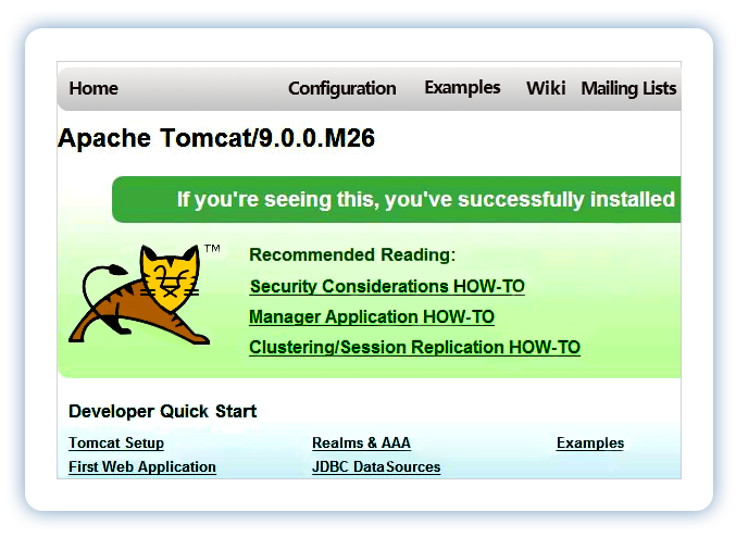
Apache
Apache 的功能与 IIS 相似,也是一款可用于网站发布和地图发布的软件,由于它具有跨平台和高安全性等优点,从而成为最主流的 Web 服务器软件之一。
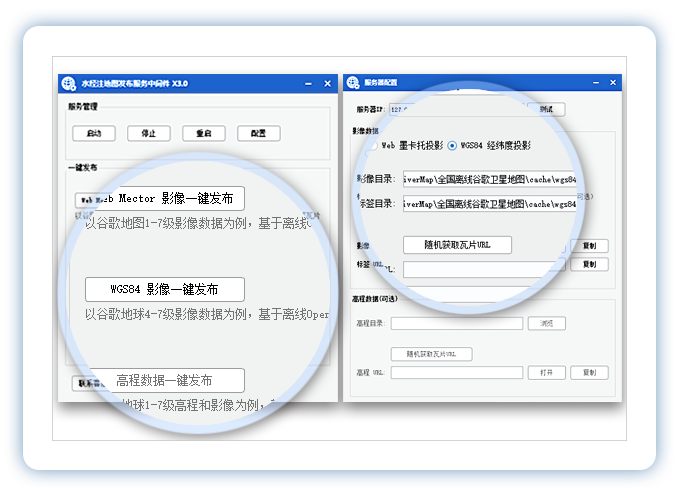
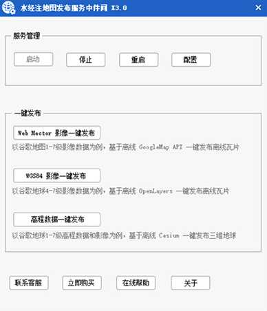
WeServer
了解更多
WeServer 的中文名称为《水经注地图发布中间件》,该软件由水经注公司完全自主研发,适合用于对全国卫星地图以及全球卫星地图等海量数据进行离线发布。
 ArcGIS
 IIS
IIS
 Apache
 WeServer
地图发布的目的
单机离线浏览全国高清卫星影像地图

局域网内构建离线Google Earth三维地球

构建互联网地图服务器

地图发布的四大必要条件

用于地图发布的离线数据

服务端的地图发布软件

显示地图发布结果的客户端平台

地图发布相关电脑硬件
水经注可用于地图发布的离线数据
全国卫星地图数据
7.01TB
全国地名标签
329GB
全球卫星影像
98TB
全国高程数据
35GB
水经注的地图发布软件
 100TB卫星地图发布
 闪电式智能检索
 不依赖数据库管理
 不依赖第三方软件


水经注对海量卫星地图进行发布会用到哪些硬件?
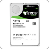
10TB希捷硬盘

100TB阵列柜
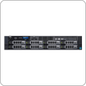
DELL服务器

触屏显示器

客户端电脑
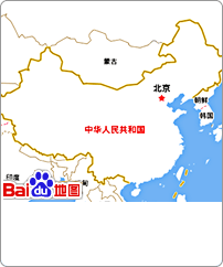
基于全国卫星地图发布的离线GIS系统方案
该系统为水经注成熟标准化基础系统,主要解决全国离线卫星影像高速发布和呈现问题,用户可以在此基础之上开发相关业务功能
全国离线卫星地图二维GIS系统
该系统可单机运行,只需要在笔记本外接8T硬盘即可,方便野外调绘作业或向客户进行系统展示。
 系统构成:
系统构成:
 硬件:服务器(可选)+客户端
 数据:全国离线卫星地图1-19级(墨卡托投影8T,WGS84经纬度投影6T)
 软件:水经注地图发布中间件
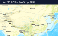
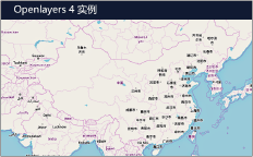
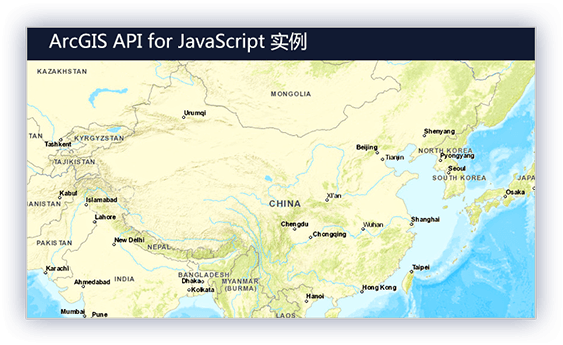
 平台:ArcGIS API for JavaScript

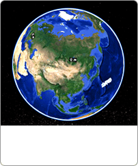
基于全球100TB海量卫星地图发布的离线GIS系统方案
可以为您在局域网快速构建一个离线三维地球基础平台,而开发人员只需要在内网专注业务功能的研发
系统构成:
硬件:服务器+100T阵列柜+客户端+触屏显示器(可选)
数据:全球离线卫星地图1-19级,WGS84经纬度投影100T
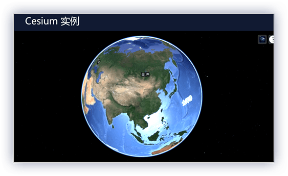
软件:水经注地图发布中间件
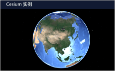
平台:Cesium 开源三维地球平台